Navionics+ Regions - Canada & Alaska
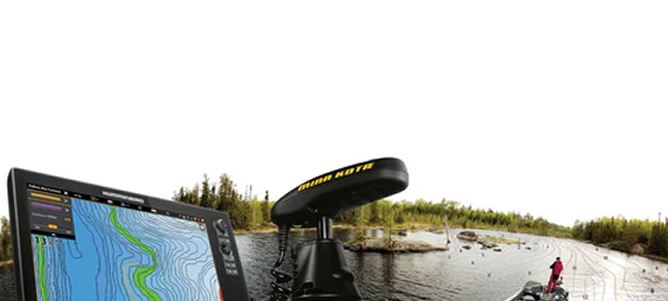
All-in-one max detailed cartography for marine and lakes makes Navionics+ the perfect choice for cruising, fishing and sailing. Get the most accurate navigational data for your GPS plotter, an exclusive 1 ft HD bathymetry map which is enhanced by boaters like you, and unique local content shared by Navionics app users. We make thousands of edits every day, so you can always have the most current charts. Daily updates and advanced features are included for one year. Includes more than 11,100 lakes. All-in-one max detailed cartography for marine and lakes makes Navionics+ the perfect choice for cruising, fishing and sailing. Get the most accurate navigational data for your GPS plotter, an exclusive 1 ft HD bathymetry map which is enhanced by boaters like you, and unique local content shared by Navionics app users. We make thousands of edits every day, so you can always have the most current charts. Daily updates and advanced features are included for one year. Includes more than 11,100 lakes.
Navionics+ provides complete inshore to offshore marine content, plus rivers, bays, and more than 40,000 lakes around the world.
The Navionics subscription
A one-year subscription to Daily Updates and advanced features is included when you purchase any new product.
After a year, you can renew at a discounted price.
Charts & Updates
- Nautical Chart - comprehensive charts derived from multiple official, government and private sources, displayed in a familiar look and feel
- SonarChart™ - innovative 1' (0.5 m) bathymetry charts created using Navionics proprietary systems
- Community Edits - useful local knowledge from edits made by users of the Navionics Boating app
Daily Updates - Up to 5,000 updates to our charts every day.
Subscription Advanced features
- Dock-to-dock Autourouting - start your trip with a suggested route
- Advanced Map Options - customize your view
- Plotter Sync - plan on mobile, go on plotter!
Free Advanced features
- SonarChart ™ Live - create your own maps
Coverage areas
Choose from very large coverage areas (Large) to more localized chart cuts (Regions).
Compatibility
Check compatibility of Navionics content and features with your GPS chartplotter.

Price Guarantee
We guarantee competitive pricing on every major brand name we stock.
Guaranteed Returns
You have 14 days from your purchase date to return or exchange your item.
Shipping information
Natural Sports will ship your order within 1-3 business days (excluding weekends and statutory holidays) of when your order is placed. Eligible Canadian* orders over $150 before taxes are eligible for free shipping, with a $40 flat-rate shipping fee on all full-sized rods and combos.
For detailed shipping information, view our shipping policy here.
Returns & Warranty
Returns
Our policy lasts 14 days. If 14 days have gone by since you have purchased an item in-store or received your online order, unfortunately we can’t offer you a refund or exchange. To be eligible for a return, your item must be unused and in the same condition that you received it. It must also be in the original packaging.
Faulty or Defective Items
Fault or defective products will be exchanged within 30 days of purchase. All other items must be returned to the manufacturer for warranty service or repair.
For detailed return and warranty information, view our return policy here.

 1572 Victoria St N.
